Property Record
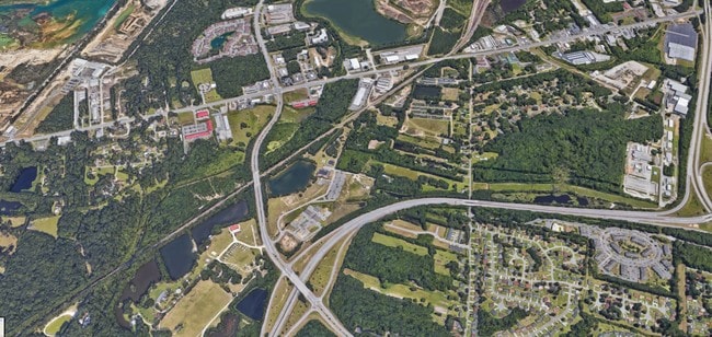
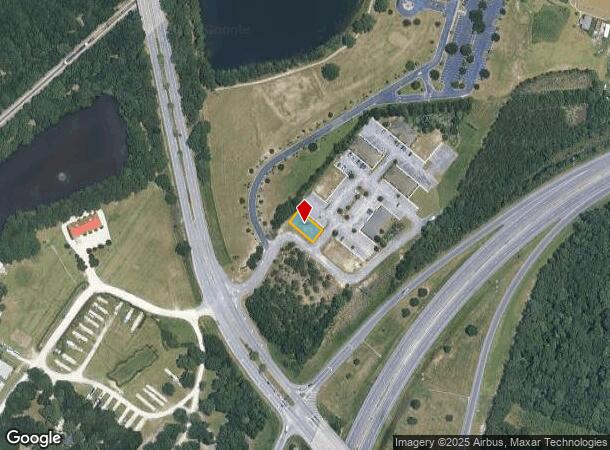
Chatham Pkwy, Savannah, GA 31405
This Property Is For Sale
NEARBY LISTINGS FOR SALE OR LEASE
Property Detail
Chatham Pkwy
Savannah, GA
LOT 1 PT OF PARCEL B PARK WAY CROSSING PRB 46P 190
2083701044
Chatham
Vacantlandnec
Georgia
X
1
13051C0145G
0.12 AC
2024
Outlying Chatham County
2025
Savannah
004500
DEMOGRAPHICS near Chatham Pkwy
1 Mile
3 Mile
5 Mile
2024 Total Population
2,975
20,498
130,337
2029 Population
3,140
21,508
136,005
Pop Growth 2024-2029
+ 5.55%
+ 4.93%
+ 4.35%
Average Age
37
38
38
2024 Total Households
1,266
7,585
53,527
HH Growth 2024-2029
+ 6.08%
+ 5.54%
+ 4.60%
Median Household Inc
$40,466
$41,289
$51,376
Avg Household Size
2.20
2.40
2.20
2024 Avg HH Vehicles
2.00
2.00
2.00
Median Home Value
$163,318
$146,921
$200,039
Median Year Built
1999
1991
1974
Nearby Places
- Restaurants
- Banks
- Shops
- Fitness
- Groceries
PUBLIC TRANSPORTATION
COMMUTER RAIL
Savannah (Palmetto - Amtrak, Silver Meteor - Amtrak, Silver Star - Amtrak)
DRIVE
WALK
Distance
Savannah (Palmetto - Amtrak, Silver Meteor - Amtrak, Silver Star - Amtrak)
9 min
4.0 mi
AIRPORT
Savannah/Hilton Head International
DRIVE
WALK
Distance
Savannah/Hilton Head International
19 min
8.7 mi
Freight Ports
Georgia Ports - Savannah
DRIVE
WALK
Distance
Georgia Ports - Savannah
15 min
7.1 mi
Nearby Properties
Address
Land Use
TOTAL SIZE
Lot Size
Zoning
Address
Land Use
TOTAL SIZE
Lot Size
Zoning
99.50 AC
M
Address
Land Use
TOTAL SIZE
Lot Size
Zoning
226,440 SF
270.14 AC
I-1
Address
Land Use
TOTAL SIZE
Lot Size
Zoning
70.49 AC
M
Address
Land Use
TOTAL SIZE
Lot Size
Zoning
0.12 AC
R6
Address
Land Use
TOTAL SIZE
Lot Size
Zoning
942,210 SF
50.60 AC
Address
Land Use
TOTAL SIZE
Lot Size
Zoning
3,515 SF
61.21 AC
I1
Address
Land Use
TOTAL SIZE
Lot Size
Zoning
489,483 SF
35 AC
PUDB
Address
Land Use
TOTAL SIZE
Lot Size
Zoning
29.50 AC
IL
Address
Land Use
TOTAL SIZE
Lot Size
Zoning
34,224 SF
20 AC
C-1
Address
Land Use
TOTAL SIZE
Lot Size
Zoning
479,600 SF
28.24 AC
IH
Address
Land Use
TOTAL SIZE
Lot Size
Zoning
21,316 SF
26.07 AC
PUDM18
Address
Land Use
TOTAL SIZE
Lot Size
Zoning
32,190 SF
22.11 AC
PUDBR
Address
Land Use
TOTAL SIZE
Lot Size
Zoning
29,304 SF
27.20 AC
R3
Address
Land Use
TOTAL SIZE
Lot Size
Zoning
33,432 SF
16.38 AC
PUDB
Address
Land Use
TOTAL SIZE
Lot Size
Zoning
413,230 SF
39.64 AC
M-CO
Address
Land Use
TOTAL SIZE
Lot Size
Zoning
810 SF
20 AC
Address
Land Use
TOTAL SIZE
Lot Size
Zoning
384,000 SF
48.45 AC
I-H
Address
Land Use
TOTAL SIZE
Lot Size
Zoning
26,124 SF
12 AC
BC1
Address
Land Use
TOTAL SIZE
Lot Size
Zoning
355,570 SF
25.41 AC
PIL
Address
Land Use
TOTAL SIZE
Lot Size
Zoning
31,710 SF
15.91 AC
PUDBR
Address
Land Use
TOTAL SIZE
Lot Size
Zoning
3,848 SF
9.14 AC
PBG
Address
Land Use
TOTAL SIZE
Lot Size
Zoning
128,061 SF
29.78 AC
R6
Address
Land Use
TOTAL SIZE
Lot Size
Zoning
11,888 SF
24.99 AC
I-H
Address
Land Use
TOTAL SIZE
Lot Size
Zoning
265,482 SF
18.85 AC
I-H
Address
Land Use
TOTAL SIZE
Lot Size
Zoning
180 SF
13.36 AC
I2
Address
Land Use
TOTAL SIZE
Lot Size
Zoning
73,992 SF
11.89 AC
PUDBR
Address
Land Use
TOTAL SIZE
Lot Size
Zoning
131,698 SF
14.78 AC
R6
Address
Land Use
TOTAL SIZE
Lot Size
Zoning
97,200 SF
30.77 AC
PUDBR
Address
Land Use
TOTAL SIZE
Lot Size
Zoning
28.95 AC
M
Address
Land Use
TOTAL SIZE
Lot Size
Zoning
22,886 SF
230.12 AC
P-RA
The World's #1 Commercial Real Estate Marketplace
Connect with us
© 2025 CoStar Group
The information above has been obtained from sources believed reliable. While we do not doubt its accuracy we have not verified it and make no guarantee, warranty or representation about it. It is your responsibility to independently confirm its accuracy and completeness. Any projections, opinions, assumptions, or estimates used are for example only and do not represent the current or future performance of the property. The value of this transaction to you depends on tax and other factors which should be evaluated by your tax, financial, and legal advisors. You and your advisors should conduct a careful, independent investigation of the property to determine to your satisfaction the suitability of the property for your needs.